|
|
|
|
Yarrow, British Columbia
Edited by
Esther Harder, Edwin Lenzmann, and Elmer Wiens
Vedder River Flats
by
Chester Brown and Elmer Wiens
 |
| Elmer Wiens and Chester Brown - August 1, 2009 |
|---|
An excerpt of this page is reprinted on the web page of the Vancouver Sun in its BC150—Celebrating Our Diversity—series.
|
Vedder River Flats |
|
Historically, people of the Sumas (Sema:th, Sum-Aht) and Chilliwack (Ch.ihl-kway-uhk, Chilukweyuk) tribes of the Stó:lō and Tzeachten Salish First Nations resided in the region around Sumas Lake. The Chilliwack traded and affiliated with the Salish tribes on the Nooksack River of Washington State by way of the Old Nooksack trail meandering between Vedder Mountain and Sumas Lake, and by way of Cultus Lake and Columbia Valley.
In 1963, the Chilliwack tribe of nine bands numbered about about 550 people. This is a population that is less than two thirds of what it was before contact with Europeans (Duff, 1997).
In recent years some historians and teachers of literature have focused on how Aboriginal people and their communities adapted to the arrival of European pioneers and settlers
who co-opted their lands. Meanwhile, First Nation writers reflect on how colonization has affected themselves, their families, and their communities, and
on their future with de-colonization: (Wiens, Elmer. First Nations Literature.)
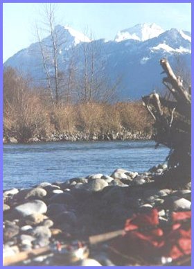
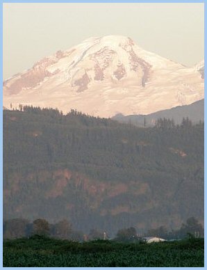
Sumas, Stewart, Street, Vedder, and Lewis Creeks, plus numerous Vedder and Sumas Mountain streams flowed into Sumas Lake, drained by the Sumas River to the north into the Fraser River. During the spring and early summer snow melt, Sumas Lake flooded and expanded, diminishing in size in the fall and winter seasons. Vedder Mountain, and the Fraser River and Sumas Mountain confine the region to the south and north. The white, snowy precipices of Mount Cheam and Mount Baker stand out to the east and southwest.
The area occupied by Sumas Lake expanded after 1875, when a logjam blocking the Chilliwack River's route through Sardis diverted some of its flow into Vedder Creek. Sumas Lake's extent expanded again after 1882, when the headwater of the Chilliwack, Luckakuck and Atchelitz streams on the Chilliwack River was blocked, causing all the Chilliwack's water to flow into Vedder Creek, later known as the Vedder River. Before 1882, the Chilliwack River twisted to the right at Vedder Crossing, continuing as the Chilliwack River through Sardis toward the Fraser River. After 1882, it curved left to overwhelm Vedder Creek, known as the Vedder River below the Vedder Crossing Bridge.
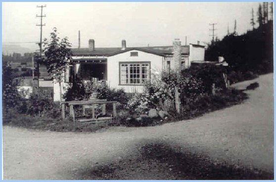
Settlement of the area by Europeans accelerated with the arrival of the Hudson Bay Company's traders (circa 1800), the Cariboo Gold Rush (circa 1858), the construction of the Collins Overland Telegraph line (1865), the Colony of British Columbia joining Canada (1871) as a province, the incorporation of the Municipality of Chilliwhack (1871), the completion of the B.C. Electric Railroad from New Westminster to Chilliwack (1910), the Sumas Lake Reclamation project (1924), and Mennonite immigration into Yarrow (1928). The Vedder, McGillivray, and Chadsey families were early settlers (circa 1860's) to the region. After their Cariboo gold-rush days, Volkert Vedder (1808-1898) and his sons, Adam and Albert, owned up to 1,200 acres of land to the east and south, and adjacent to Sumas Lake, known as the Vedder Ranch. Adam Vedder (1834-1905) was a Member of the Provincial Parliament, and served as Warden of the Township of Chilliwhack. Donald McGillivray (1838-1913) farmed 800 acres on Sumas Prairie until 1903, after which he moved to Chilliwack. He was a Member of the Provincial Parliament, and served as Reeve of the Municipality of Chilliwhack. William (1843-1906) and Mary Jane (1845-1936) Chadsey were among the first settlers on Majuba Hill. During the gold rush, William and his brother, James, shipped hermetically sealed cans of butter to the Cariboo gold fields from their Chilliwack and Sumas area farms. Following this successful venture, they built and operated the first flour mill in the Chilliwack area. After the 1894 Fraser River flood, the Chadsey's built and occupied homes on Majuba Hill. From 1900 to 1910, William and his son Lockhart served as postmasters of the Majuba Hill Post Office (Coutts 109-110). James Hounsome succeded Lockhart Chadsey as postmaster. In 1912, Hounsome relocated the post office from Majuba Hill to his house north of Yarrow Station, on the shore of Sumas Lake. On January 1, 1914 this Post Office was renamed to Yarrow. In 1927, William and Ella Siddal (1885-1976) followed Hounsome as postmaster. They had built a "house and store south of Yarrow Station" in 1920, on the mountain side next to the railway tracks (Coutts 112). The picture below shows Siddall's store, post office, and house south of the BCE railway tracks at Yarrow Station, with Yale Road on the right and Wilson Road heading north on the left. The telephone poles in the background run next to the BCE Railway tracks. The footbridge in the foreground crosses the spillway creek from the Yarrow Reservoir, which flowed along the east side of Wilson road to join Stewart Creek. For many years, salmon spawned here, arriving from the Fraser River by way of the Sumas River and Stewart Creek.
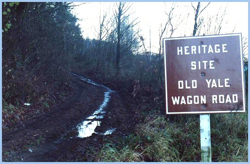
Today, the Majuba Heritage Park is situated on the site of Sidall's house, store, and post office. Yale Road is now the Heritage Site called the Old Yale Wagon Road that runs along the foot of Vedder Mountain to Vedder Mountain Road.
Majuba Hill consisted of the bench on Vedder Mountain situated south of Sumas Lake, and bisected by the Yale-Westminster Highway. Begun in 1865 and completed in 1875, this highway continued to the north to cross Vedder Creek by way of a bridge, and to the west to skirt Sumas Lake on its way to Fort Langley. Sometime around 1885, Frank and John Lumsden acquired the Vedder Ranch. The brothers incurred financial difficulties when their project to drain Sumas Lake proved unsuccessful. Apparently, John Sampson (1858-1940) leased the Vedder Ranch (circa 1895), living at the Vedder's homestead house, and sharing title to the property with the British Columbia Land and Investment Company. Circa 1898, the British Columbia Land and Investment Company obtained full title to the Vedder Ranch, which they held until 1905. In 1905, Joseph Knox (c. 1857 - 1931) and Margaret Knox (1845 - 1910) procured the ranch. Circa 1908, Knox sold to Ernest Crain and Chauncey Eckert a large portion of his farm west of Yale Road (Wilson Road), which at that time proceeded due north to the Vedder River from the eastern extremity of Majuba Hill.
The B.C. Electric Railway, completed in 1910, divided what came to be Yarrow: "Yarrow Proper" west of the tracks up to Boundary Road, the "Vedder River Flats" east of the tracks and north of Vedder Mountain up to the Vedder River, and "Majuba Hill" south of the tracks on Vedder Mountain. Affectionately or derisively depending on one's point, the Vedder River Flats were known locally as "The Bush." Today, properties on Majuba Hill are prized for their views; then, settlers preferred the productive farms on the plain of Yarrow and Sumas Prairie. While the settlement of "Yarrow Proper" waited for Sumas Lake to be drained in 1924, the settlement of the "Vedder River Flats" was facilitated by the relocation of the Yale-Westminster Highway (c. 1908 - c. 1920) along Vedder Mountain from Majuba Hill to Vedder Crossing. This new road next to the mountain was known at first as Yale Road, and subsequently as Vedder Mountain Road.
Yarrow Pioneers: Vedder River Flats
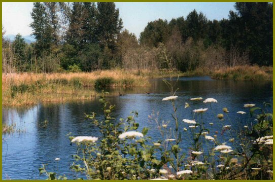
The land east of Sumas Lake, overshadowed by Vedder Mountain, cut and ravaged by the Vedder River, was a rugged area. During the late summer, fall, and early winter, sizeable runs of spawning salmon invaded Sumas Lake, the Vedder River, and their tributary creeks, joining resident fish that included nimble cutthroat and rainbow trout, lissom whitefish, indolent olive green dolly varden, tiny, prickly sticklebacks and minnows, bristly languid suckers, and huge scavenging Pacific sturgeon. Vast flocks of geese and ducks, and occasional groups of trumpeter swans populated Sumas Lake, while pheasant and grouse inhabited the thickets of pussy willows, poplar trees, and blackberry bramble patches. Deer, bear, coyote, bobcat, and cougar roamed the mountainside and flats covered by hefty cottonwood, maple, hemlock, fir, and cedar trees.
Click on the photograph for a larger version!
Travelling west from Vedder Crossing one passes a few farms lying between the highway and the Vedder River. Then, one encounters Ford Road, Browne Road, and Martin and Simmons' Road jutting from Vedder Mountain Road and Vedder Mountain. Browne Road and Ford Road, proceeding due north to the Vedder River, are joined by the barely discernible Duncan Road. Browne Road and Martin and Simmons' Road share a junction off Vedder Mountain Road. Martin and Simmons' Road, later known as Lumsden Road, runs due west, ending at the BCE Railway tracks near its Vedder River bridge. Bergman Road juts north to the Vedder off Lumsden Road, while Simmons Road juts south to the mountain. Knox's farm consists of the rectangular area east and next to the BCE Railway tracks. Emails and letters exchanged with Chester Brown depict with text and photographs many of the early settlers of Majuba Hill and the Vedder River Flats. Pioneers cleared these lands to develop farms for livestock and produce.
Chester Brown writes, "To the east of Yarrow, a dozen or so families lived on the Browne and Ford Roads, and a few more along the Yale Road east of Ford Road as far as Vedder Crossing, about three and a half miles from Yarrow. The one-room Vedder Mountain School served these families until 1926, when it was closed. For the 1926-1927 school year, these children were trucked, first to Majuba Hill for a half term, and then to Atchelitz School. From 1927 to 1929, students in grades 6 through 8 from Majuba Hill and east along Yale Rd were trucked to Sardis School. Starting in 1928, younger students from Majuba Hill attended the new Elementary School located at the south-west corner of present day Yarrow Park."
The farms of the pioneers of Vedder Mountain Flats were located along Martin and Simon's (Lumsden), Browne, Duncan, and Ford Roads, and east of Ford Road along Vedder Mountain Road The Abe Simmons and Jack Martin families owned farms on their road.
Mrs Simmons was the sister of Rosa Martin and Jack Martin.
Hudson Family Edward (c. 1865-1940) and Esther Hudson (1869-1956) were early pioneers, who cleared land on Duncan Road and built a house. To the west, a wagon road connected the Hudsons to Majuba Hill and Yarrow Station. This wagon road continued east to Ford Road which proceeded north to the Vedder River, possibly crossing the river by way of a gravel ford to connect with Lickman Road in South Sumas (Greendale) north of the river.
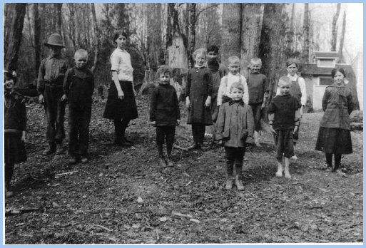
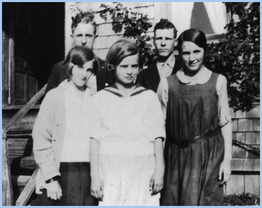
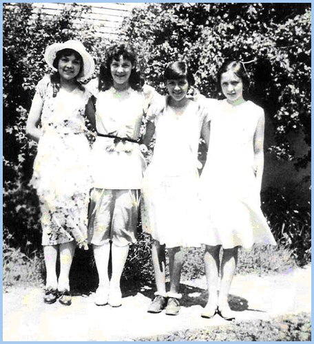
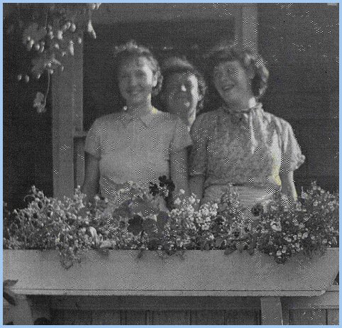
— Photographs Courtesy of Donald Hudson — Being somewhat isolated, the young people of the Vedder River Flats and Majuba Hill, generally socialized amongst themselves in homes, or at parties and dances in the Vedder Mountain and Majuba Hill Schools.
Chester Brown states, "Mother's uncle Edward Hudson married Esther, his bride from London, in 1907 in Vancouver, and they had a son, also named Edward. The Hudsons bought 15 acres off what later became Browne Road south of a wagon road, near Yarrow, sometime in the early to mid 1910's. They sold the property and moved away in the early 1920's. Edward junior married and had two sons, Donald and Gordon. They had successful professional careers, and are now retired now on Vancouver Island."
Brown Family Chester Brown writes that his father, Ernest William Browne, was born in Shropshire in 1871, and in 1889 immigrated alone to Vancouver, Canada, working at whatever he could find for some years. He changed his name to Robert Brown because of the disfavour Englishmen faced in the job market at that time (his name sounded and looked just too English), started working on coastal boats around the turn of the century, and obtained his Master Mariner certificate in 1907. He skippered tugboats out of Vancouver as Captain Brown until 1930, when the economic depression and his ill health forced him out of work permanently.
"My mother, Elizabeth Hudson, was born in London, England in 1883, serving a long apprenticeship as a seamstress / fitter / tailor. She immigrated to Vancouver with her uncle, Edward Hudson, in 1907, where she met Dad. They married in December 1908. She worked at her trade until my sister, Annetta, was born in 1917." "In 1918, my parents, Robert and Elizabeth Brown, bought 15 acres on Browne Road, immediately south of Duncan Road (then only a wagon road), and west of the Hudson's homestead. Soon after this purchase, through a long-term payment agreement with the Soldier Settlement Board, they bought the adjoining 20 acres to the south, next to Browne and Yale Roads. They cleared a few acres on the 15-acre parcel and built a tiny house, to which they added over the next few years."
"The barn my father built in the 1920's beside what is now Duncan Road was still standing in 1982, a testimony to good workmanship."
"Because Dad's work was based in Vancouver, my mother raised two kids, kept a cow, a pig, chickens and a large garden all on her own — an amazing achievement for a woman raised in London with no rural experience!"
"Our neighbours in the earliest years included the Duncans, across the wagon road (Duncan Road) and immediately north of us; Hudsons, directly east of us; Mortons, east of Duncans; George Rowtasch, the Swiss farmer, west across Browne Road; Martins and Simmons on the neighbourhood's largest farms on their road (now Lumsden Road); and Latties south of Yale Road at Browne Road junction. Later, the Currence family bought Latties; Nickels bought Duncans; Johnsons bought Hudsons; Downings bought the property north of Duncans; and Nowells bought west of George Rowtasch. Roy Rexford built a little house in the "V" between Yale Road and Martin and Simmons' Road."
"In 1930, we moved to the Johnson's (Hudson's) 15-acre property, which we bought for $5000. The house built by my mother's uncle, Edward Hudson Sr., was situated south of the "S" curve of Duncan Road. Our friends included classmates from the Majuba Hill and other area schools that my sister, Annetta, and I attended. From among our circle, Margaret Maitland and Annetta remained fast friends throughout their lives."
"In 1931, we sold the 15-acre Browne Road property to a Mennonite family. The 20-acre property's ownership, at Browne Road junction, reverted to the Soldier Settlement Board in 1935."
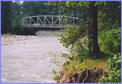
Chester Brown writes, "The BC Electric Railway was completed in 1910 to provide passenger and freight transport from Vancouver / New Westminster to Chilliwack, and beyond to the Fraser River and the old Yale Road. There were stations at Yarrow and Belrose on both ends of Majuba Hill, and a flag stop south of the Vedder River Bridge at the end of Martin and Simmons' Road. To shop in Chilliwack, we flagged the BC Electric Interurban train.
"Usually, we shopped for day-to-day staples in Yarrow at Bill Siddall's store, at Yarrow Station along Yale Road."
"For my first year of High School in Chilliwack, I lived in a house owned by the Maitlands in Chilliwack. Parents of Yarrow students staying in this house rotated in providing care for us. Thereafter, I cycled the ten miles to Chilliwack from Duncan Road, regardless of the weather. The road to Chilliwack could be dangerous. On one occasion on my way to school, a car driven by someone travelling to Vedder Crossing from Chilliwack struck me in Sardis, and I spent some time recovering from my injuries in the Chilliwack General Hospital. However, I persevered to get my education, despite the hazards presented by inclement weather, road conditions, and careless drivers." "Yale Road traversed the valley west of Sumas Lake, crossed the BCE rail line a mile or so southwest of Belrose Station, followed the lower slopes of Vedder Mountain to a half mile east of Yarrow, and then continued along its present route next to the mountain to Vedder Crossing. This road provided the only overland, road route up the Fraser Valley south of the river."
"Even after the Vedder Canal Dykes were built in 1924 and Sumas Lake was drained, Sumas Prairie was subject to flooding."
When an ice storm cut the power lines in 1935 to the Sumas pump-station, much of Sumas Prairie was flooded with disastrous consequences for the crops of tobacco. The two biggest players on Sumas Prairie, the Canadian Tobacco Company and the Totem Tobacco Company, were put out of business. In 1936, a group of small tobacco farmers formed the Sumas Tobacco Growers Co-operative Association, selling its tobacco leaf to Imperial Tobacco of Eastern Canada (Sleigh 69-72). Chester Brown writes, "In 1935, I moved to the Okanagan. My parents lived in Yarrow until 1938, after which they moved to Burnaby. My sister, Annetta, changed her name to Adrian, trained as a nurse in New Westminster, and married an electrical engineer by the name of Alton Hurt. After serving with the Canadian Navy during the war in the Pacific and Eastern Mediterranean Zones, I attended U.B.C.
Having obtained a degree in geography at U.B.C., I worked in Saskatchewan for a while. I married Margaret Gibson at the age of 34; we have three chilren. I worked for the federal government in Ottawa until my retirement in 1976."
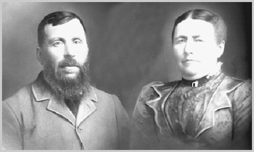
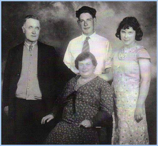
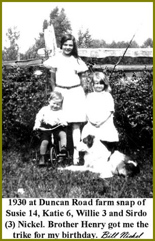
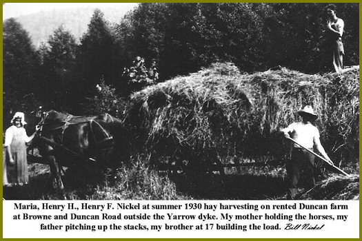
Heinrich H & Maria (Decker) Nickel Family
Remembering Yarrow
I was six that spring. Where was my home? I may well have wondered for I had literally been on the move since conception. First, still in the womb, by Model T from Kansas to Washington. Then as a baby I was moved by train to Ohio and several farm places there. At age one, it was back in the car, a 1924 Studebaker then, by slow trek and various stops and north to the Canadian border and the newly settled Yarrow Village. That was the new Mennonite Brethren land of promise where recently arrived Russian Mennonite refugees could re-create there sect’s old country order in the New World.
The book, A Generation of Vigilance, the biography of Johannes Harder and his wife Tina, was written by retired Saskatchewan University history professor and author, T. D. Regehr and published by the CMU Press of Winnipeg at the behest of the Yarrow Research Committee and the editor of its Yarrow history, Leonard Neufeldt. After advised of the book's publication I picked up my copy of the book, glanced at it briefly and found it somewhat hard to revisit those Depression days again.
Derksen—Wiens Family In 1928, Mennonite settlers arrived to purchase parcels of land Chauncy Eckert subdivided from his Knox Farm purchase. Many of these settlers came from farms on the provinces of Alberta, Saskatchewan, and Manitoba.
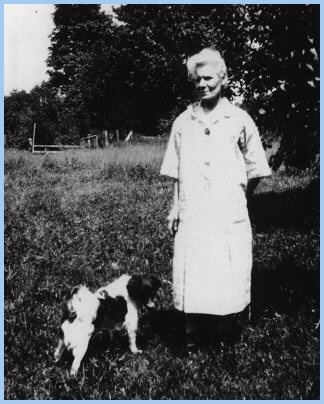
As the availability of lots from Eckert's Yarrow subdivision diminished, settlers spilled onto the Vedder River Flats and up Majuba Hill, acquiring existing farms or subdivided acreage. Elmer Wiens writes, "In 1929, four of my Grandfather Julius Derksen's brothers, Johann, Henry, Gerhard, and Peter, lived in Yarrow. Meanwhile, my grandparents and their children worked their wheat farm in Blumenhof, Saskatchewan, south of Swift Current."
"In 1936, the Derksen family relocated to Yarrow, acquiring property on the west side of Ford Road (Giesbrecht Road) contiguous to the Vedder River."
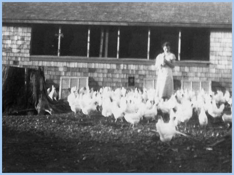
The Derksens raised chickens, milked dairy cows, and grew potatoes, corn, and berries on their Vedder River farm. The family income was supplemented with work in the hop yards and tobacco fields on Sumas Prairie. During the 1930's and 40's, many young women of Yarrow lived and worked in Vancouver as care givers and domestics, commuting home to Yarrow by way of the BC Electric Interurban trains. For a while, Katie Derksen worked as a nanny for a "wealthy Eaton family."
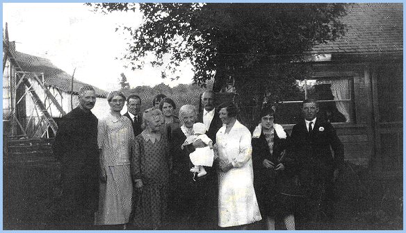
Elmer Wiens continues, "My Aunt Sara married George Siemens on March 28, 1937 in the Yarrow, MB Church. After farming in Saskatchewan for a few years, Uncle George and Aunt Sally bought the farm east of Browne Road adjacent to the Vedder River, and west of the Derksen farm on Ford Road. My Uncle Jake died on December 30, 1938, and was buried in the Yarrow Cemetery at the end of Alder Road (Hare Road)." "On March 16, 1939 my parents, Katie Derksen and George Wiens, married in the Yarrow MB Church."
George and Katie purchased and operated the twenty-acre farm at the northeast corner of Browne Road and Vedder Mountain Road, formerly owned by Mr Robert Brown. Along with dairy cows, chickens, and hogs, they harvested strawberries, raspberries, potatoes, and corn."
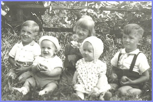
George and Katie's children, Raymond, Elmer, Luetta, and Alfred, enjoyed playing in the barns and fields, and fishing for trout in the salmon stream (Street Creek) flowing through the farm. Chester Brown fondly recalls fishing this same stream during the 1920's and 30's, when the Browns owned the property.
Each fall, the family picked hops on Sumas Prairie, getting up before dawn, returning home in the evening to finish farm chores. Weigh-up-time determined the essence of a day picking hops. The picked hops accumulated in one's basket were dumped into sacks and weighed. This measure of the day's labour was punched onto a ticket, redeemable for money at the end of hop-picking season at the hop-company office.
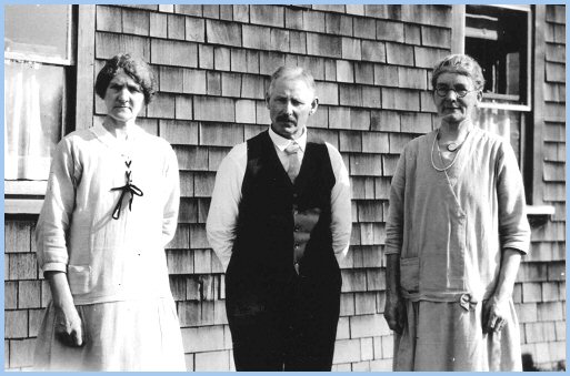
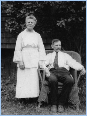
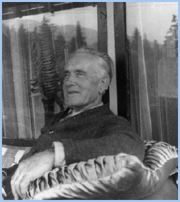
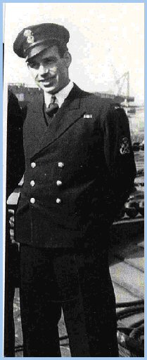
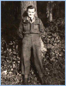
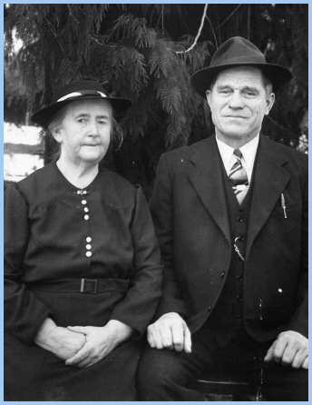
Elmer Wiens continues, "In 1944 my Uncle Julius joined the Canadian Armed Forces. The next two pictures show Uncle Julius in his military uniform visiting my grandparents, and my grandfather preparing to visit someone on his bicycle on Sunday afternoon. The Vedder River can be seen in the background."
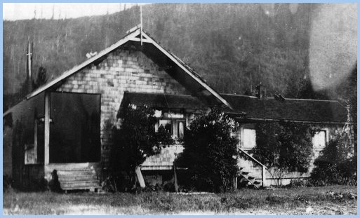
"Following the 1946 spring flood, my grandparents moved to Yarrow onto a few acres, just west of the Yarrow MB Church; my Siemens cousins moved to a 100-acre farm on Sumas Prairie.
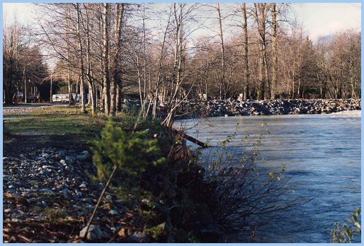
Today, the Derksen Vedder River farm is the Vedder River Campground, operated by the Cultus Lake Parks Board."
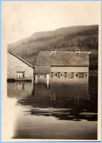
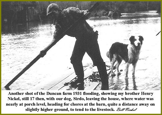
Yarrow pioneers suffered brutal hardships from the flooding of the Vedder and Fraser Rivers ensuing from the annual, spring snow melts on British Columbia's massive mountains. The severe flood in May and June of 1948 was the outcome of a number of concurrent circumstances. Cool weather during the spring delayed the thawing of the substantial accumulation of snow in the mountains until late May. Over the Victoria Day weekend, temperatures spiked, rapidly melting the mountains' snow pack, substantially raising the water levels of the Fraser and Vedder Rivers. At the same time, the moon's position in relation to the earth and the sun (lunar perigee on May 15; full moon on May 22; solar summer solstice on June 21) caused unusually high tides that slowed the flow of the Fraser River, backing up the Vedder River. Consequently between May 28 and June 3, a number of dykes were breached, flooding large tracts of land in the region of the confluence of the Fraser and Vedder Rivers (Lenzmann).
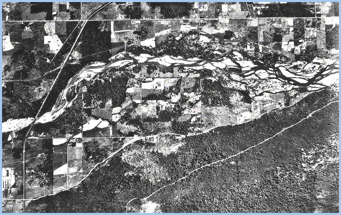
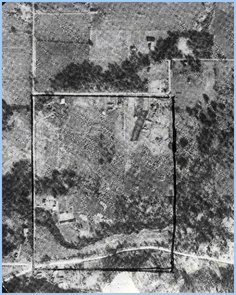
Elmer Wiens writes, "My father built a dam on our creek to irrigate the berry patches, corn fields, and hay pastures. Street Creek was fed by the runoff from Vedder Mountain, and a yearlong spring on the Dyck farm east of us on Vedder Mountain Road. Each fall, various species of salmon spawned in our creek. The coho and steelhead fry remained in the creek for almost a year, while the pink and chum fry left for the ocean soon after hatching." The next aerial photograph reveals the Vedder River Flats north of Vedder Mountain Road and east of Browne Road. One can see the Wiens farm in the lower left, north and east of the Browne Road junction with Vedder Mountain Road. The Bunse family lived on the mountainside south of this junction. Street Creek, edged by trees and blackberry bushes, rambles north of the highway crossing Browne Road between George Rowtasche's farmyard to the southwest and the Wiens farmyard to the northeast. Farther to the north, one can see the original Brown homestead, occupied in 1949 by the Dueck family. East along Duncan Road, one sees the site of the Hudson homestead south of Duncan Road, just before its sharp "S" curve. Here, the Giesbrecht farm was sited north of Duncan Road. Click on the photograph for a larger version!
If one proceeded north along Ford Road from its junction with Vedder Mountain Road in 1945 (see larger aerial photo), one immediately passed the Dyck farm on the left, and then another Dyck family's farm on the right across the road from the Jacob Janzen family, finally arriving at the Vedder River with Derksen's farm on the left. Proceeding west along Duncan Road, one arrived at the farm the Giesbrecht family purchased in 1948 at the "S-corner." In 1945, the Henry Brucks family lived directly south across Duncan Road on the old Hudson homestead. Farther west along Duncan Road, one passed Reimer's farm to the left, and arrived at the Dueck farm at Duncan Road's junction with Browne Road. The Kopps, Nikkels, Redekops, and Siemens' families clustered on farms near the Vedder River on Browne Road.
"There was always something happening on our farm. We could watch Dad milking the cows in the early evening, check out the new chicks in the chicken barn, help gather eggs, peer over the pen railing as the hogs gulped down their victuals, or look for snakes in the lumber pile."
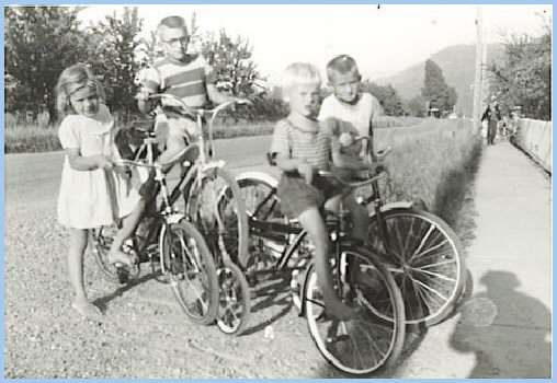
"In the spring of 1953, my parents sold our farm to the Gross family, and we moved to a 3-acre hobby farm in Yarrow at 1012 Central Road, next to the G.G. Baerg family. My mother used the proceeds from the sale of the irrigation equipment from the Browne Road farm to buy each of us children a bicycle."
"That fall, Yarrow School moved to the Pink School on Wilson Road with classes from grades one to nine. On the first day of school, we gathered at the old school in downtown Yarrow, and then we all marched along Central and Poplar Roads to our new school in the morning, Indian summer sunshine. They had painted the doors to the classrooms red, yellow, or blue. My girlfriend, the cute Brown girl who sat beside me at our desk in grade one, and between Rob and me in grade two, didn't return to our school that year. Our grade three teacher until Christmas, Mrs. Sharples, assigned me to sit behind Rita, who always wore such neat belts that year. My lost Roy Rogers lunchbox was replaced by a new Lone Ranger one. It was a wonderful day!"
| ||||||||||||||||||||||||||||||||||||||||||||||||||||||||||||||||||||||||||||||||||||||||||||||||||||||||||||||||


 We moved into our new 14'x20' shack on the 4 acre Yarrow farm at the dyke in 1934, starting bare bones scrambling for food and shelter in the depths of the Great Depression. The advantages of our 'great American dream' experience, already lost in five short years, left us as 'poor white trash' among our contemporaries of the closed religious society of Depression Yarrow. Many of the more recent CPR and MCC sponsored immigrants who found their way to Yarrow during this period were hungrier, in the sense that they were more anxious to recover the lost glories of their pre-revolutionary villages in Russia. Many were more aggressive, harder working, more cohesive and less sensitive to the express or implied criticism of the larger English speaking community all around.


|
Copyright © Elmer G. Wiens: EgwaldTM Web Services
|
